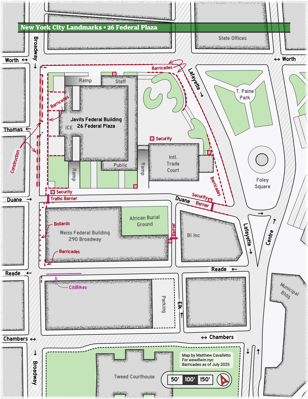
To facilitate planning for some upcoming protest activity, I put together a simple map of the area around 26 Federal Plaza and Foley Square.
As shown below, traffic to the adjacent portion of Duane Street is restricted by vehicle barriers; pedestrian access is generally allowed but barriers are kept nearby and can be closed easily.
Leave a Reply