Category: Maps

  • Map of Times Square Area

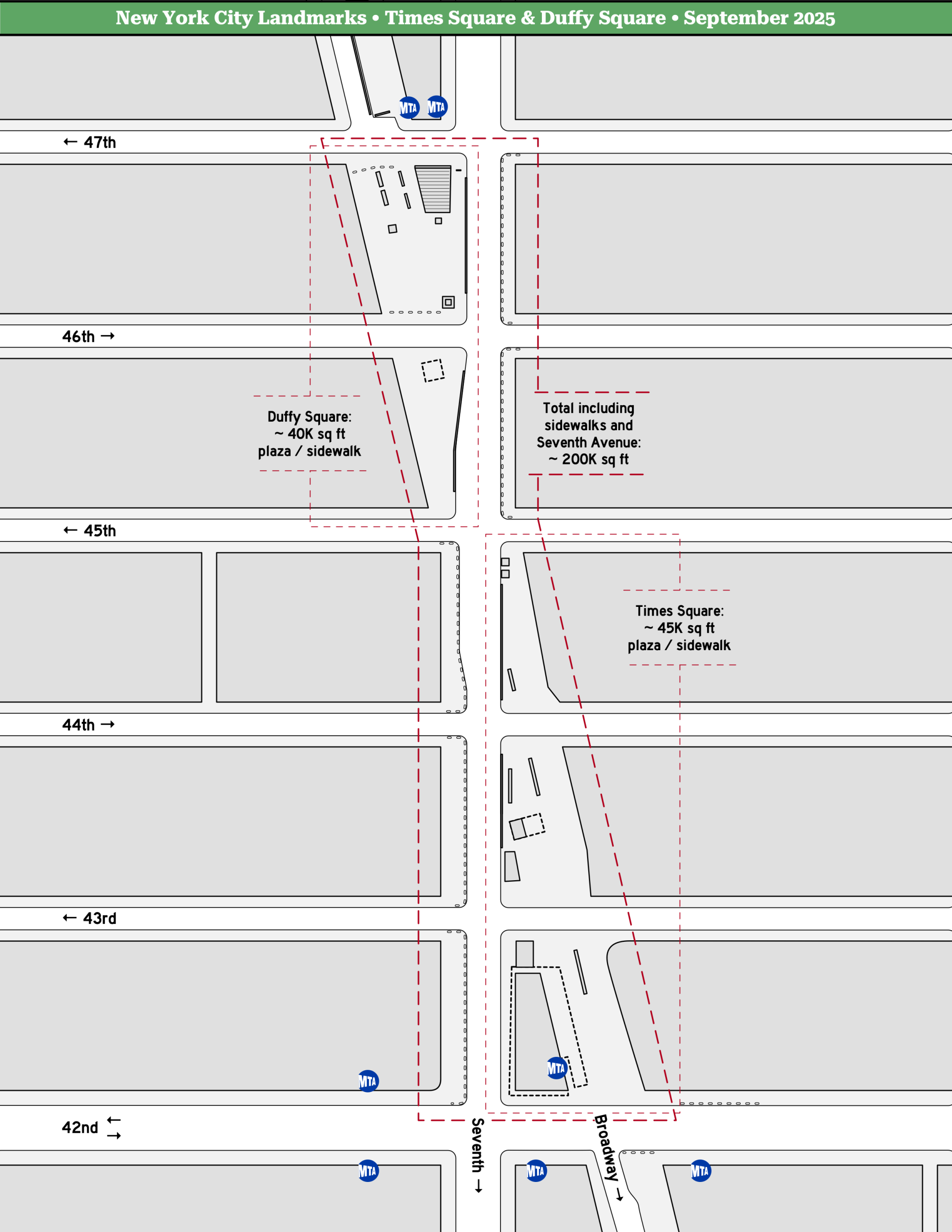
    We’re considering holding some upcoming protest actions in the Times Square area, so I visited the area and made some notes to overlay on a simple line map that folks can use for planning purposes.

    The crowding of tourists, office workers, and theaters goers does make this a challenging location, but it’s incredibly iconic — if you see a crowd photo taken here, you instantly know it’s from New York City.

    Click image to enlarge.

  • Map of NYC Federal Sites

    In anticipation of a possible Federal deployment to New York City this autumn, I put together a visual reference showing the location of Federal buildings, including office towers and court houses.

    I also included the city’s National Park sites, including monuments and memorials, as they also fall under Federal jurisdiction, although several of them are located too far away to be shown on this map.

    Click to enlarge. Map from OpenStreetMap / Apple. Federal sites from gsa.gov and nps.gov.

  • Map of Federal Plaza Area

    To facilitate planning for some upcoming protest activity, I put together a simple map of the area around 26 Federal Plaza and Foley Square.

    As shown below, traffic to the adjacent portion of Duane Street is restricted by vehicle barriers; pedestrian access is generally allowed but barriers are kept nearby and can be closed easily.

    Click to enlarge.